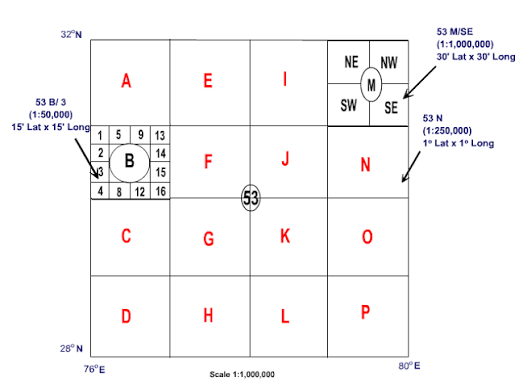
A topographical map, or toposheet, is a detailed map that represents both the natural and human-made features of an area. Unlike a general-purpose map that may show only selected features, a topographical map provides a systematic picture of the landscape.
Natural features such as relief, rivers, streams, lakes and vegetation are shown together with human-made features such as settlements, roads, railways, canals and administrative boundaries. Relief—the height and shape of the land—is commonly represented using contours and spot heights.
Topographical maps are prepared at a fixed scale and use standardized symbols, colours and coordinate references. This allows distances, directions, elevations and locations to be measured accurately from the map.
Because detailed information cannot be shown clearly for an entire country on a single sheet, the mapped area is divided into a systematic series of topographical map sheets. Each sheet covers a particular geographic area and is assigned a sheet reference, making it possible to identify and organize maps at different scales.
How Topographical Map Sheets Are Divided and Numbered
A country or a large region cannot be represented in sufficient detail on a single topographical map. Therefore, the mapped area is divided into a series of map sheets. Each sheet covers a specific area of latitude and longitude and is given a unique reference so that it can be identified easily.
The system is hierarchical. It begins with a large sheet covering a broad area. That sheet is then divided into progressively smaller areas. As the geographic area represented by each sheet becomes smaller, the map scale becomes larger and more detail can be shown.
Million Sheets
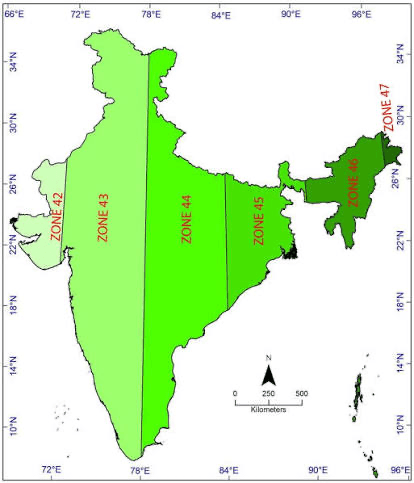
In the Indian topographical map-sheet system shown in the figure, the broad division begins with million sheets, prepared at a scale of 1:1,000,000. Each million sheet is identified by a number, such as 53, 54, 63 or 64.
Million Sheets
Before looking at topographical map sheets, it is useful to distinguish them from the UTM zones discussed earlier. UTM divides the Earth into longitudinal zones for establishing a projected coordinate system. Topographical maps use a separate map-sheet indexing system to organize maps covering different geographic areas.
From UTM Zones to Map Sheets
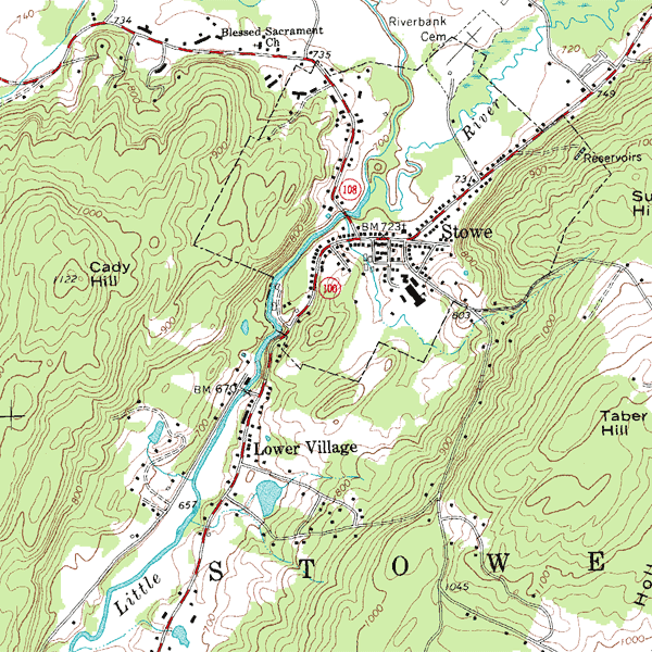
India extends across several UTM zones. These zones provide the coordinate framework, but they are not the same as topographical map sheets. To publish and organize detailed maps systematically, the country is divided into separately identified map sheets.
Topographical sheet → a particular map covering a defined geographic area
The Million-Sheet Division
The broad topographical sheet division begins with million sheets, mapped at a scale of 1:1,000,000. Each million sheet covers 4° of latitude × 4° of longitude and is identified by a number, such as 53, 54, 63 or 64.
For example, Sheet 53 extends from approximately 28°N to 32°N and 76°E to 80°E. At 1:1,000,000 scale, 1 cm on the map represents 10 km on the ground.
A Million Sheet Becomes the Parent Sheet
A million sheet is not the final level of mapping. It acts as a parent sheet that can be divided into progressively smaller geographic areas. These subdivisions allow maps to be produced at larger scales and with greater detail.
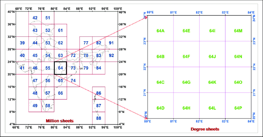
For example, Million Sheet 53 can be divided into sixteen 1° × 1° degree sheets, labelled A to P. Those sheets can then be subdivided again for more detailed topographical mapping.