
India’s home-grown GPS alternative, Navigation with Indian Constellation (NavIC), was designed to give the country strategic independence in satellite navigation. Developed by the Indian Space Research Organisation, the system is now facing satellite failures and slow global adoption. These issues could shape the future of India’s space-based navigation ambitions.
What is NavIC?
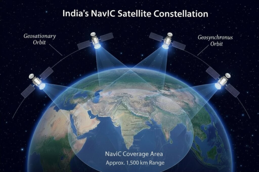
Navigation with Indian Constellation (NavIC) is India’s regional satellite navigation system developed by the Indian Space Research Organisation. It was originally known as the Indian Regional Navigation Satellite System (IRNSS) and became operational in 2018. The system uses a group of satellites orbiting Earth that continuously transmit positioning signals. These signals allow devices such as smartphones, ships, and navigation receivers to determine their location. NavIC was designed to provide positioning accuracy of about 5–20 meters across India, with coverage extending roughly 1,500 km beyond the country’s borders.
Why India Needed Its Own Navigation System
Satellite navigation systems are now a critical part of modern infrastructure. They power smartphone maps, aircraft navigation, shipping routes, disaster management, and military operations. Most of the world relies on the American Global Positioning System (GPS), but several countries have developed their own systems. These include GLONASS (Russia), Galileo (European Union), and BeiDou Navigation Satellite System (China). By building Navigation with Indian Constellation (NavIC), India aimed to ensure that it would not have to rely entirely on foreign navigation systems during emergencies or geopolitical crises.
The Problems NavIC Is Facing
Despite its strategic importance, NavIC has faced several challenges. One major issue has been failures in the rubidium atomic clocks used in some satellites. These clocks are essential because navigation systems depend on extremely precise timing to calculate positions. Another challenge is limited adoption in smartphones. Although some chipsets from Qualcomm support NavIC signals, many devices still rely mainly on GPS and other global navigation systems. NavIC also has a limited coverage area. Unlike GPS or BeiDou, which provide global coverage, NavIC is primarily designed for India and nearby regions, making it less attractive for international applications.
What Happens Next?
India is already working on next-generation NavIC satellites designed to improve signal reliability and compatibility with global navigation frequencies. If these upgrades succeed, Navigation with Indian Constellation (NavIC) could become an important part of India’s digital infrastructure, supporting transportation, logistics, disaster response, and national security. For now, however, NavIC highlights an important reality: building a satellite system is only the first step—ensuring reliability and widespread adoption is the real challenge.