

What is UTM? UTM stands for Universal Transverse Mercator. It is a global coordinate system based on the Transverse Mercator Projection. Instead of representing the whole Earth with one continuous map projection, UTM divides most of the world into narrow zones. Each zone is projected separately so that distortion remains relatively small within that area.
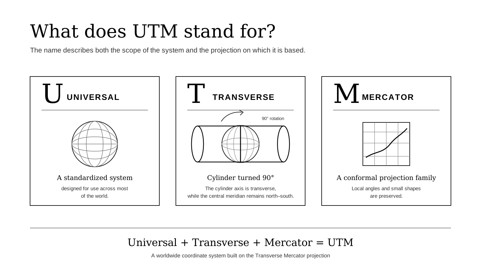
How is it a cylindrical projection? The Transverse Mercator belongs to the cylindrical family of map projections. In the normal Mercator concept, the cylinder is oriented around the equator. In the Transverse Mercator, the cylinder is turned through 90 degrees, so the projection is centred on a selected central meridian.
What is a transverse cylindrical projection?
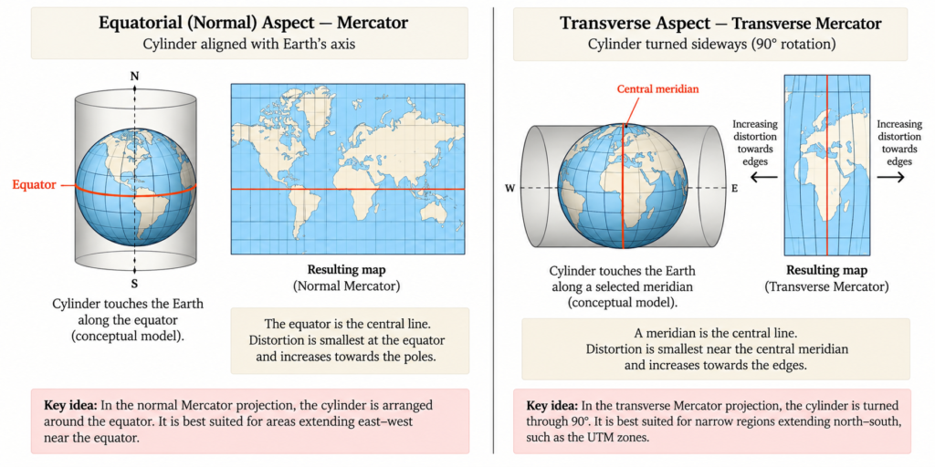
The Transverse Mercator is a cylindrical projection, but the cylinder can be positioned in different ways around the Earth. In the equatorial or normal aspect, the cylinder is placed around the Earth with its axis aligned with the Earth’s polar axis. In the simple cylindrical model, the equator is the central line of contact. This is the arrangement used to explain the ordinary Mercator projection.
In the transverse aspect, the cylinder is turned through 90 degrees. Instead of being centred on the equator, the projection is centred on a selected meridian, called the central meridian. This arrangement is particularly useful for mapping narrow areas that extend from north to south.
The UTM system uses the Transverse Mercator projection. It applies this transverse arrangement to narrow parts of the Earth so that distortion can be kept relatively small within each area.
What is the secant cylinder concept?
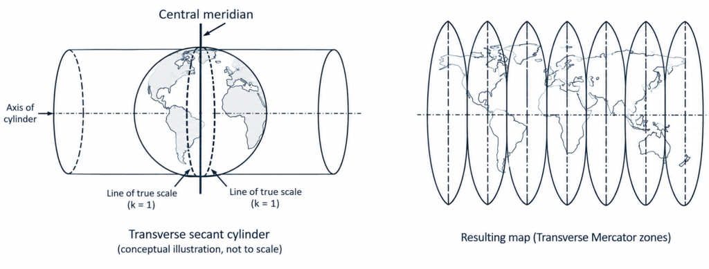
UTM uses a slightly modified form called the secant Transverse Mercator. Instead of imagining the cylinder simply touching the Earth along the central meridian, the cylinder is positioned so that it conceptually cuts slightly through the Earth.
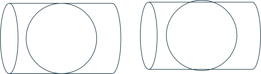
This produces two lines of true scale on either side of the central meridian and helps distribute distortion more evenly across the mapped area.
The scale factor along the central meridian is:
k₀ = 0.9996
This means the scale along the central meridian is slightly reduced. Moving outward from the central meridian, the scale increases until it becomes true along two lines, and then increases slightly beyond them.
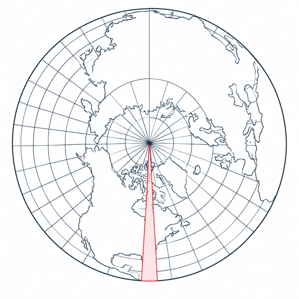
Why Secant Projection?
The secant arrangement helps to reduce and distribute scale distortion around the central meridian. However, as we move farther east or west from the central meridian, distortion still increases.
For this reason, a single Transverse Mercator projection is not used for the entire Earth. Instead, it is applied to a narrow strip of longitude around its central meridian.
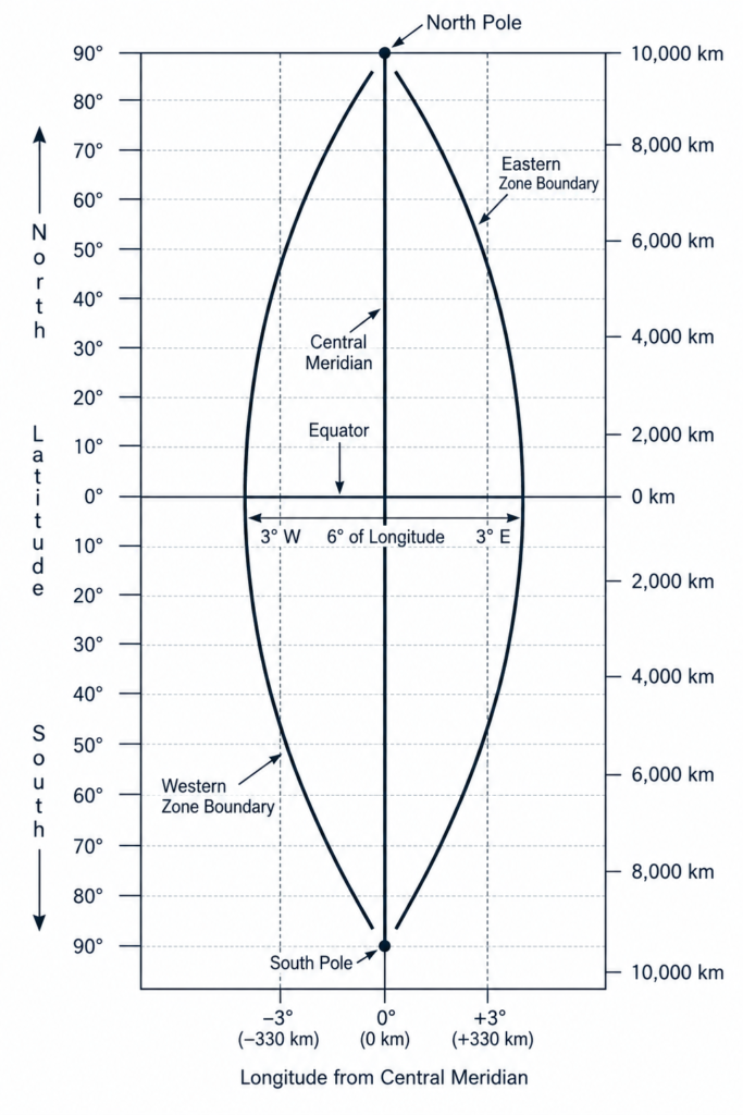
In the UTM system, this strip is normally 6° wide, extending 3° to the west and 3° to the east of the central meridian. Keeping the projected area narrow helps keep scale distortion relatively small throughout the strip.
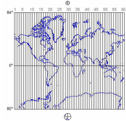
To cover the Earth, a separate Transverse Mercator projection is used for each of these 6°-wide strips. These strips are called UTM zones.
Since the Earth covers 360° of longitude:
360° ÷ 6° = 60 zones
Therefore, the UTM system divides the Earth into 60 longitudinal zones, each with its own central meridian and its own Transverse Mercator projection.
Why Do We Need 60 UTM Zones?
The important idea is that UTM does not treat the Earth as one continuous projected map. Each zone functions as a separate mapping system, with its own Transverse Mercator projection centred on its own central meridian.
As we move around the Earth from one zone to the next, the projection is effectively re-centred on a new central meridian. This allows the same low-distortion mapping arrangement to be repeated around the globe rather than allowing distortion to accumulate across one very wide map.
This also means that UTM coordinates are zone-specific. The same Easting and Northing values can occur in different zones, so a UTM position is not complete unless we also know which zone it belongs to.
The UTM Grid System
Once the Earth has been divided into UTM zones, we can look at how locations are measured within an individual zone.
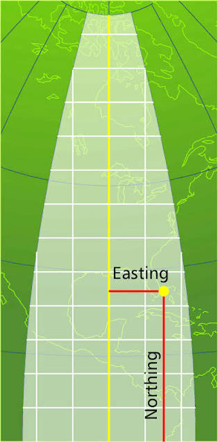
Unlike latitude and longitude, which describe positions using angular measurements in degrees, UTM uses a rectangular coordinate grid measured in metres. A position within the grid is described using two coordinates called Easting and Northing.
Degrees to the UTM Grid
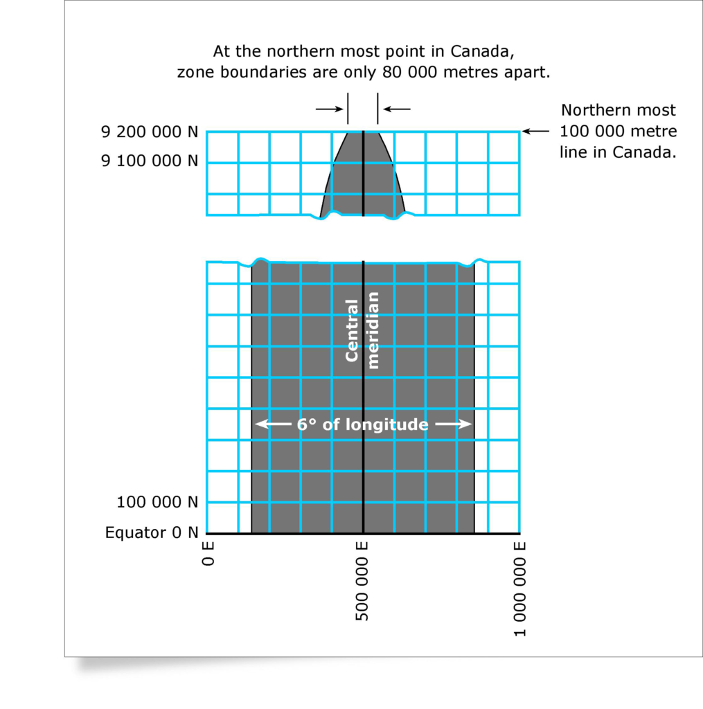
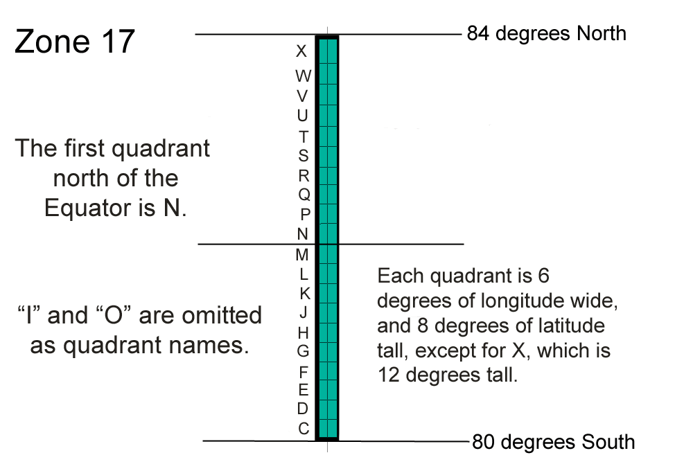
First, longitude divides the Earth into UTM zones. A standard UTM zone is 6° of longitude wide, extending approximately 3° west and 3° east of its central meridian. Latitude determines how far north or south a position lies within that zone.
When that curved 6° strip is projected using the Transverse Mercator projection, a rectangular coordinate grid is placed over it. The horizontal coordinate is called Easting, and the vertical coordinate is called Northing. Both are measured in metres, rather than degrees.
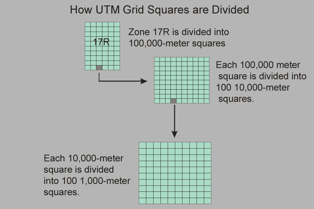
The grid itself does not have one fixed number of squares. It can be subdivided according to the scale and accuracy required. For example, maps may show 100 km, 10 km, 1 km, 100 m, or smaller grid intervals. A 1 km grid square represents 1,000 m × 1,000 m in the UTM coordinate system.
WGS 84 UTM Zone Finder
Enter a latitude and longitude, or click anywhere on the map. The tool identifies the UTM zone, hemisphere, WGS 84 EPSG code, central meridian, false origins and central-meridian scale factor.
- Zone number
- —
- Hemisphere
- —
- Latitude band
- —
- WGS 84 EPSG
- —
- Central meridian
- —
- Longitude span
- —
- False easting
- 500,000 m
- False northing
- —
- Scale factor k₀
- 0.9996
60 zones
Standard UTM divides longitude into 60 zones, each nominally 6° wide and numbered eastward from 180°W.
One central meridian
Each zone has its own central meridian. The Transverse Mercator projection is centered on that meridian.
Metre-based grid
Within a zone, positions are expressed as Easting and Northing coordinates in metres rather than angular longitude and latitude.
Educational note: the finder includes the standard Norway and Svalbard UTM zone exceptions. UTM is normally used from 80°S to 84°N; polar regions use other systems such as UPS. The map is an equirectangular locator for selecting coordinates—the UTM grid itself is not drawn in this world-map view.