
What is traverse or traversing in a survey?
Traversing in surveying is a method of establishing a control network by measuring the angles and distances between a series of points. The points are called traverse stations or traverse points. The lines that connect the traverse stations are called traverse lines.
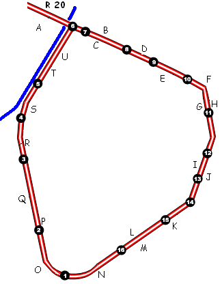
There are two main types of traverses: closed and open

A closed traverse starts and ends at the same point. This type of traverse is often used to establish a control network for a small area.
An open traverse starts at one point and ends at another point. This type of traverse is often used to establish a control network for a large area.

The measurements taken in a traverse are used to calculate the coordinates of the traverse stations. The coordinates can then be used to map the area that was surveyed.
Traversing is a versatile surveying method that can be used in a variety of applications, such as:
- Mapping land
- Establishing property boundaries
- Site planning
- Construction layout
- Engineering design
- Geodetic surveys
Traversing is a fundamental surveying technique that is used in many different fields. It is a reliable and accurate method of establishing control networks and mapping areas.
Here are the steps involved in traversing:
- Select the traverse stations. The traverse stations should be evenly spaced and should be located in areas where the ground is relatively flat.
- Measure the angles between the traverse lines. The angles can be measured with a theodolite or transit.
- Measure the distances between the traverse stations. The distances can be measured with a tape or chain.
- Calculate the coordinates of the traverse stations. The coordinates can be calculated using the measured angles and distances.
- Check the accuracy of the traverse. The accuracy of the traverse can be checked by comparing the calculated coordinates to the known coordinates of the traverse stations.
Traversing is a complex process, but it is a valuable tool for surveyors. By following the steps outlined above, surveyors can establish accurate control networks and map areas with confidence.
Methods of Traversing
There are four main methods used in traverse surveying:
- Chain traversing is the simplest method of traversing. It is done by measuring the distances between the traverse stations using a chain or tape. The angles between the traverse lines are not measured. This method is only suitable for small areas with relatively flat terrain.
- Compass traversing is done by measuring the magnetic bearings of the traverse lines using a compass. The distances between the traverse stations are not measured. This method is only suitable for areas where the magnetic declination is known and is not too large.
- Theodolite traversing is the most accurate method of traversing. It is done by measuring the angles between the traverse lines and the distances between the traverse stations using a theodolite. This method is suitable for all types of terrain.
- Plane table traversing is a graphical method of traversing. It is done by plotting the traverse lines on a plane table and then measuring the angles between the traverse lines using a compass. The distances between the traverse stations are then calculated using the measured angles and the known scale of the plane table. This method is not as accurate as theodolite traversing, but it is more portable and can be used in areas where it is difficult to set up a theodolite.
The method of traversing that is used will depend on the accuracy requirements of the survey, the type of terrain, and the availability of equipment.
Here are some of the factors to consider when choosing a method of traversing:
- Accuracy requirements: The more accurate the survey needs to be, the more precise the method of traversing that should be used.
- Terrain: Some methods of traversing are more suitable for certain types of terrain than others. For example, chain traversing is not suitable for areas with rough terrain.
- Availability of equipment: Some methods of traversing require more specialized equipment than others. For example, theodolite traversing requires a theodolite, which is a more expensive piece of equipment than a chain or compass.
Least count of traversing method
The least count of a traversing method is the smallest measurement that can be made with that method. The least count for different traversing methods are as follows:
- Chain traversing: The least count of chain traversing is typically 0.01 meters. This is the smallest measurement that can be made with a chain or tape.
- Compass traversing: The least count of compass traversing is typically 1 degree. This is the smallest measurement that can be made with a compass.
- Theodolite traversing: The least count of theodolite traversing depends on the theodolite being used. It can be as low as 1 second of arc or even lower.
- Plane table traversing: The least count of plane table traversing depends on the scale of the plane table being used. It can be as low as 1 millimeter on the plane table.
The least count of a traversing method will affect the accuracy of the survey. The smaller the least count, the more accurate the survey will be.
By taking care to minimize these factors, surveyors can improve the accuracy of their traverse surveys.