Roman thinkers played a significant role in the advancement of geography, contributing to areas such as cartography, topography, and early climate theories. Their works were built upon Greek foundations but were also influenced by the vast territorial expanse of the Roman Empire, which required practical geographic knowledge for administration, military strategy, and trade.
The study of geography in the Roman era was deeply connected to their imperial ambitions. Accurate maps, road networks, and descriptions of lands and peoples were essential for governance and expansion. Roman scholars like Strabo, Ptolemy, and Pliny the Elder documented vast regions, providing detailed insights into the known world. They categorized lands based on climate, topographical features, and cultural characteristics, influencing medieval and early modern geography.
However, distinguishing individual Roman geographers is often challenging due to the transitional nature of the Roman Empire. The shift from the Roman Republic to the Roman Empire, and later the division between the Western and Eastern Roman Empires, led to the blending of Greek, Egyptian, and Persian influences into Roman geographical thought. Many scholars, such as Ptolemy, lived during Roman rule but were influenced by earlier Hellenistic traditions, making it difficult to strictly classify them as Roman thinkers.
Despite this complexity, Roman contributions to geography were profound, shaping European and Islamic geographic traditions for centuries.
Strabo (64 B.C. – A.D. 24/25)
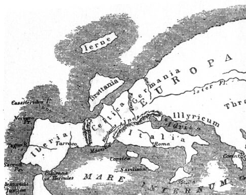
- Known as the Father of Regional Geography for his focus on natural boundaries (rivers, mountains, seas) rather than political borders.
- Wrote Historical Memoirs (43 volumes), which are now lost.
- His most important work, Geographica (17 volumes), describes various regions, landscapes, people, and cultures.
- Divided the world into natural divisions rather than using political territories, a unique approach for his time.
- His work combined history and geography, making him more of a historical geographer than a purely scientific one.
- Criticized Herodotus, calling him a “retailer of fables” for what he saw as exaggerated or unreliable accounts.
- Had firsthand geographical knowledge only of areas he personally visited, relying on other sources for distant regions.
- The only ancient geographer to integrate historical, political, physical, and mathematical sciences into his work, making his studies comprehensive and multidisciplinary.
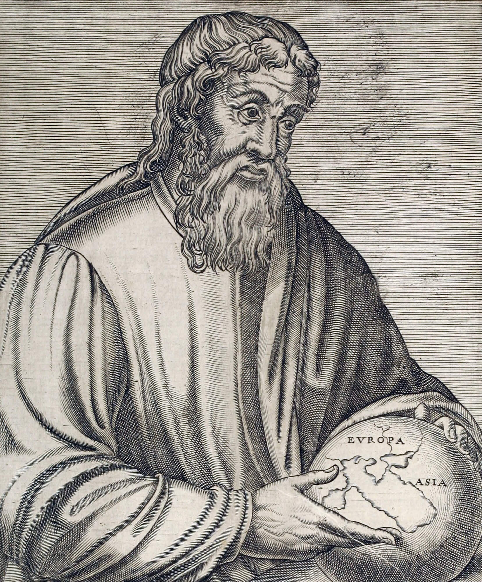

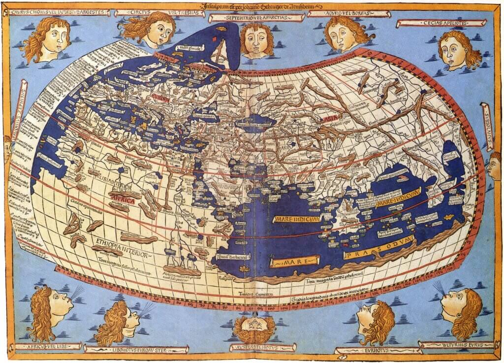
Ptolemy (A.D. 90–168)
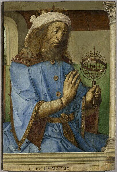
- Claudius Ptolemy was a Roman by-citizenship (Greco-Egyptian by ethnicity) geographer, mathematician, and astronomer from Egypt (likely based in Alexandria).
- Made major contributions to mathematical geography, introducing concepts that shaped map-making for centuries.
- His most famous work, The Almagest (Syntaxis Mathematica), is a 13-book treatise on planetary motion, star cataloguing, and celestial mechanics. It presents a mathematical model of planetary motion, supporting the geocentric theory (Earth at the centre of the universe).
- Optics, a smaller work on vision, light, and refraction, was also written by him.
- His second most important work, Geographia (The Guide to Geography), includes detailed maps, coordinate systems, and projections, setting the foundation for modern cartography. He created a coordinate system using latitude and longitude, refining Eratosthenes’ work. Created detailed maps of the known world, though some were highly inaccurate. It lead explorers like Christopher Columbus to underestimate the size of the Earth.
- A strong follower of Hipparchus, building on his astronomical and geographical theories.
- His Geographia became a standard reference for medieval and Renaissance mapmakers, significantly influencing European cartography.
- Tetrabiblos meaning “Four Books”, is a major astrological treatise written by Ptolemy in the 2nd century A.D. It is considered one of the most influential works on astrology in both the ancient and medieval worlds.